
The view from above Yosemite Valley as you come out of the Wawona Tunnel is stunning. I mean take your breath away, jaw droppingly stunning. So much so, that all I could do was sit there on the edge of that stone wall and stare at the expanse of trees, shining granite monoliths and ribbon-like waterfalls that appeared before me. It felt like being in a dream, or getting a momentary glimpse of heaven, but each time I blinked it was still there in front my eyes. While it may seem like a dream from a distance, actually being in Yosemite Valley is very much a call to reality. A place this beautiful can’t help but become an international tourist destination, and so it has precariously taken on that role with a mix of grace and strain.

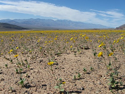
Yosemite Valley is a treat for all the senses. Verdant green meadows carpet the valley floor, making the contrast between the vivid blue sky and stark white granite domes all the more brilliant. Prior to park service development, the leisurely Merced River flowed freely and replenished the lush meadows by occasionally flooding. To reduce the potential for flooding, provide dry ground for camping and decrease mosquito populations, the river was forced into a more predictable pattern of flow and some of the meadows were drained during the first years of park development. Such changes cut off life sustaining water to these valley jewels and in recent decades, attempts have been made to reinstate more natural processes. Meadow drainage tiles have been removed and where possible, the river is being unbound and allowed to flow as it prefers. Boardwalks throughout the valley now intersect this reinvigorated ecosystem, allowing visitors to wander through the sea of green and more closely observe the scattered wildflowers, wetland birds and grazing mammals that live there.
Waterfalls in the springtime roar inescapably throughout the valley, booming and reverberating off the surrounding stone walls, making the undulating white columns of water in the distance all the more palpable. Humid sprays of water amplify the smell of the trees and soil near the falls, giving the air a saturated, fresh smell. Thousands of people wander around the Yosemite Falls area with their eyes cast upward in awe, speaking dozens of different languages, gesturing animatedly as they interpret the maps and educational displays that explain the beauty before them. The trail system around the falls recently underwent a major renovation to allow for better flow of visitors and reduce soil erosion resulting from overuse. The wide, paved trails now allow those visitors, both young and old, with less physical mobility to more safely enjoy the forested, boulder strewn landscape, and inspiring vistas.
By afternoon, the initial rush of excitement has mellowed and if you give into it, a growing sense of peaceful wonder will descend upon you. Sunshine wash es warmth over every surface, while the cooling alpine breeze chases away discomfort. On the back porch of the historic Ahwahnee Hotel guests and passersby relax, while soaking up the ambiance and grandeur of the park reflected through the structure’s immense stone walls. Providing an interesting juxtaposition between refined civility and the wildness that surrounds it, the hotel was built in 1926 to attract wealthy patrons seeking relaxation and restoration. During WWII park tourist visitation decreased dramatically, but war weary soldiers found still found refuge at the Ahwahnee, which was converted for use as a military retreat. The architects took their design inspiration from the landscape and used locally sourced materials to increase the sense that this place is a part of, rather than an escape from, the natural wonders of valley.
 Pensive photographers of all ages raise their cameras to frame shots, while plein air painters place their brushes with care in an attempt to capture a moment that will remind them when they return home, that this surreal place really does exist. Rock climbers laden with coils of rope, their steps accented by the clink of hardware on their belt, scramble over boulder piles leading to the base of El Capitan, Half Dome and dozens of other lesser known climbing walls for the thrill of merging with the geologic wonders of the valley. Thousands of cars squeeze into every available parking space, and in the afternoon fellow tourists on foot and bicycle shake their heads in amazement at the bumper to bumper traffic snaking slowly back home during the afternoon rush hour. If you are looking for solitude, this is not the place for you. If you want to see nature untouched by significant human development, there are plenty of other places in the Sierra Nevada to visit. But if you are looking for natural beauty of the kind rarely seen with such ease, and the communal experience of marveling at that beauty with so many other people from across the country and around the globe, then Yosemite Valley is a place you should experience for yourself.

Yosemite Valley is a treat for all the senses. Verdant green meadows carpet the valley floor, making the contrast between the vivid blue sky and stark white granite domes all the more brilliant. Prior to park service development, the leisurely Merced River flowed freely and replenished the lush meadows by occasionally flooding. To reduce the potential for flooding, provide dry ground for camping and decrease mosquito populations, the river was forced into a more predictable pattern of flow and some of the meadows were drained during the first years of park development. Such changes cut off life sustaining water to these valley jewels and in recent decades, attempts have been made to reinstate more natural processes. Meadow drainage tiles have been removed and where possible, the river is being unbound and allowed to flow as it prefers. Boardwalks throughout the valley now intersect this reinvigorated ecosystem, allowing visitors to wander through the sea of green and more closely observe the scattered wildflowers, wetland birds and grazing mammals that live there.

Waterfalls in the springtime roar inescapably throughout the valley, booming and reverberating off the surrounding stone walls, making the undulating white columns of water in the distance all the more palpable. Humid sprays of water amplify the smell of the trees and soil near the falls, giving the air a saturated, fresh smell. Thousands of people wander around the Yosemite Falls area with their eyes cast upward in awe, speaking dozens of different languages, gesturing animatedly as they interpret the maps and educational displays that explain the beauty before them. The trail system around the falls recently underwent a major renovation to allow for better flow of visitors and reduce soil erosion resulting from overuse. The wide, paved trails now allow those visitors, both young and old, with less physical mobility to more safely enjoy the forested, boulder strewn landscape, and inspiring vistas.
By afternoon, the initial rush of excitement has mellowed and if you give into it, a growing sense of peaceful wonder will descend upon you. Sunshine wash
 es warmth over every surface, while the cooling alpine breeze chases away discomfort. On the back porch of the historic Ahwahnee Hotel guests and passersby relax, while soaking up the ambiance and grandeur of the park reflected through the structure’s immense stone walls. Providing an interesting juxtaposition between refined civility and the wildness that surrounds it, the hotel was built in 1926 to attract wealthy patrons seeking relaxation and restoration. During WWII park tourist visitation decreased dramatically, but war weary soldiers found still found refuge at the Ahwahnee, which was converted for use as a military retreat. The architects took their design inspiration from the landscape and used locally sourced materials to increase the sense that this place is a part of, rather than an escape from, the natural wonders of valley.
 Pensive photographers of all ages raise their cameras to frame shots, while plein air painters place their brushes with care in an attempt to capture a moment that will remind them when they return home, that this surreal place really does exist. Rock climbers laden with coils of rope, their steps accented by the clink of hardware on their belt, scramble over boulder piles leading to the base of El Capitan, Half Dome and dozens of other lesser known climbing walls for the thrill of merging with the geologic wonders of the valley. Thousands of cars squeeze into every available parking space, and in the afternoon fellow tourists on foot and bicycle shake their heads in amazement at the bumper to bumper traffic snaking slowly back home during the afternoon rush hour. If you are looking for solitude, this is not the place for you. If you want to see nature untouched by significant human development, there are plenty of other places in the Sierra Nevada to visit. But if you are looking for natural beauty of the kind rarely seen with such ease, and the communal experience of marveling at that beauty with so many other people from across the country and around the globe, then Yosemite Valley is a place you should experience for yourself.
  The olive groves are in "bloom" right now, which may not appear very spectacular from the highway, but close up the flowers have their own unique beauty.


 Stovepipe Wells campground by moonlight


